Articles
| Name | Author | |
|---|---|---|
| Case Study: Fuel savings at Transavia | Thomas Aliguen, Fuel Manager, Transavia, and Alex Feray, CEO at OpenAirlines | View article |
| Column: The World according to IT and me.. Pithy Bites | Paul Saunders, Solution Manager, Flatirons Solutions | View article |
| The Digital Revolution: Connectivity and Mobility in Operations at Air Canada | Steve Bogie, Senior Director, Operations IT, Air Canada | View article |
| Go Direct with Free Route Airspace | Uwe Nitsche, Co-founder and CEO, RocketRoute | View article |
Go Direct with Free Route Airspace
Author: Uwe Nitsche, Co-founder and CEO, RocketRoute
SubscribeGo Direct with Free Route Airspace
Uwe Nitsche co-founder and CEO of RocketRoute and Software Vendor Representative on Eurocontrol considers the implications and benefits of Free Route Airspace changes in Europe
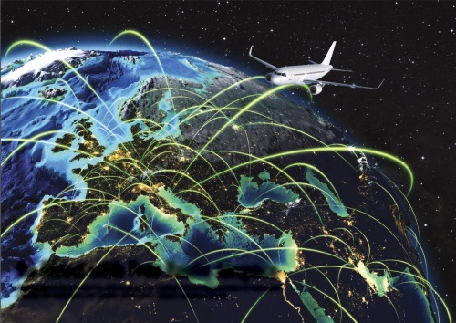
The management of European airspace will be going through a major transformation during the next four years as airspace is opened up to Free Routing and the availability of Free Route Airspace (FRA). This means change for every part of the aviation industry from Eurocontrol, Airlines, ANSPs (Air Navigation Service Provider) and Avionics Manufacturers to pilots, planners and dispatchers. Everyone needs to adapt, prepare systems, ensure safety and then enjoy the opportunity to plan and fly direct flights. But before even that happens, it will be useful to better understand Free Route Airspace, the idea at the heart of these changes.
What Free Route Airspace means for commercial aviation
Free Route Airspace (FRA) means airspace that is available for aircraft to fly through free of pre-defined routes such as Airways. A more interesting consideration is what Free Route Airspace is not. Despite the name, it is not airspace where flights can fly wherever they like. There are still many things to consider for the aircraft operator. For example, if an area is declared an FRA, an Aircraft operator still has stay clear of obstacles such as Mountains and man-made obstacles as well as other dangerous operating areas, such as where active military operations are taking place. Consequently, in many ways, FRA transfers responsibility to define safe and available routes from authorities and regulators to the aircraft operator.
FRA was initiated in Europe in 2008 and included in the Flight Efficiency Plan. The background is that European Airspace is some the most intensely regulated airspace in the world. This naturally leads to inefficiencies which are, conversely, likely to be addressed with more regulation. As Europe has set a goal for European flight efficiency, Free Route Airspace was seen as an approach which could unlock the potential of a freer way of routing air traffic throughout Europe. The idea being that traffic could choose the most efficient routes and altitudes and thus reduce fuel consumption and carbon emissions as well as flight delays brought about by the very restricted routes available in the past.
An additional factor is the progress that has been made in navigational capabilities most prominently by Satellite Based Navigation Systems such as US Global Positioning System (GPS). In the past, ground based beacons would allow aircraft to navigate routes. However, due to the limited number of ground based systems (navaids) all routes would lead through these ground based navigational points creating an airway structure. Although aircraft are, by their nature, not bound to fixed routes in the same way that cars are by the road network, this created an artificial restriction of available airspace and increased congestion around these points with much of the surrounding airspace unused. When Area Navigation Systems (RNAV) became popular and widely available many additional points, defined only by longitude and latitude, were established and at very low cost, as no additional ground based equipment needed to be installed, calibrated or maintained.
However the system of connecting these points via airways was maintained. As more such points were defined (5 Letter Name Codes – 5LNC) more and more connections were needed. It is only in recent times that the fact that this is an unnecessary solution was understood by many involved parties and the obvious solution to abandon the creation of ever more airways and, moreover, abandonment of all existing airways was considered a viable solution.
The project has since been progressed by individual nations and partnerships, such as the Scandinavian cross border free route airspace initiative which is planned to come into effect in November 2015. But, it should be noted that many projects labelled as FRA are, in reality, very limited with airways being removed only at certain times; airways remaining but overlapping; direct routing being temporarily allowed, or airways being removed but only routings between officially designated points being allowed. And there are many more combinations of such restrictions being implemented as part of some FRA projects.
What will be the effects of FRA…
… on the sector?
FRA in its current transitional state significantly impacts the sector. It means that operators have to deal with a mixture of systems and regulations both spatial as well as time related. Overall there is a need for investment by the sector to use the newly available FRA which is balanced by the ability to optimize routings and potentially reduce fuel consumption and possibly congestion. According to Eurocontrol as a result of the current free route projects, flying distances would be reduced by approximately 7.5 million nm, this representing the equivalent of 45,000 tons of fuel saved, or reduced emissions of 150,000 tons, or savings of 37 million Euros.
… on regulators and air space controllers?
FRA has huge impact on regulators. The divisions responsible for airspace route design have been building processes and best practices over many years around an existing framework which is now being completely replaced. Operational and safety aspects have to be completely reassessed plus information distribution has to be assessed and redesigned. Although these can be costly and time consuming, they also often lead to leapfrogging innovation.
In addition, resources within the organizational structures are affected as traffic distribution can suddenly change and thus air traffic control sector and associated staff distribution need to be redesigned and redistributed. Although an aircraft can freely move and adjust quickly to new traffic flows, the ground based infrastructure cannot so easily be readjusted. Fortunately modern remote communication technology and remote radar access mitigates this to a large extent and forces fast paced innovation by regulators to meet the new FRA requirements. However this also requires significant investment.
… on airlines and operators?
FRA transfers responsibility to the operator to deal with safety aspects directly. Airways are designed to provide safe navigation and often guarantee minimum navigational and communication capabilities. In FRA the operator becomes largely responsible to ascertain whether a planned route is safe and within the navigational and communication capabilities of the crew and aircraft. Additionally FRA requires training for planners and pilots alike and, as new operational gaps are identified, new definitions and solutions are needed to fill these; for example potentially very long directs must contain a certain number of calculation points to allow crew to check fuel status and for position reports to be made similarly as is currently done during oceanic operations.
Who FRA will affect and what advance preparations they’ll need to make
FRA will ultimately affect all airspace users, associated authorities and controlling agencies. Possibly even many users such as VFR users that do not expect it, due to the likely airspace changes and re-designs.
The effect of FRA on flight planning and route planning/flying
Flight planning will be significantly affected as an important part of the burden to assure safety is transferred to the operators. Routes need to be planned such that they are optimized for the operator’s needs, remain clear of obstacles and terrain and avoid all dangerous or restricted airspace. (Note that, within free route airspace, military airspace blocks and dangerous areas, such as laser test sites etc. remain in effect.)
The implications of FRA for operations software developers and vendors
Developers of planning systems will need to take into account the safety aspects of a route which previously was covered by the restrictions surrounding defined routes. In addition the optimization algorithms need to focus on other aspects such as weather wind, traffic sector loads and the ever more dynamic nature of airspace sectors within FRA and their availability (Airways would route around these by design).

Some examples of FRA initiatives
Free Route Airspace available 24 hours a day, above a certain flight level (FL)
In many cases this form of implementation is chosen to avoid the terrain clearance problems discussed earlier. It also avoids de-regulation of traffic flows in the lower airspace around and through terminal airspace (airspace around large airports, which remains congested). Portugal was one of the first states to introduce 24-hour FRA in the upper airspace, the outcome of which showed good traffic improvements and can be credited for spurring other nations to follow.
Free Route Airspace available during night time or seasonally above a certain FL
This is often used to trial FRA concepts (Finland for example has had FRA during night time for some while now). However, time related restrictions such as these have significant negative impact on planning, such as for flights that depart before the activation of FRA but are inside or have planned to enter the airspace during activation of this airspace. Most people will be familiar that flights sometimes do not depart exactly on the planned time. The exact time may not be known until the aircraft actually takes off, at which time the flight plan may be invalid as FRA is no longer available or Airways have disappeared. To mitigate this, some states have introduced buffer times or put Airways infrastructure in place during FRA times
Enter and exit Free Route Airspace via FIR (flight information region) Waypoints
This is often introduced to minimize the required organizational changes by the Air Traffic controlling agencies as traffic hubs remain largely unchanged. With true cross-border FRA, such as is being introduced in November 2015 in Scandinavia, traffic can enter an FIR at any given latitude and longitude. Often, on traffic handover, the ATC systems cannot deal with traffic that has no pre-defined waypoint but is on a free vector awaiting further instructions. Thus, as an interim measure, defined entry/exit points are created to allow the sector that the flight is leaving to direct traffic there and notify the receiving sector with this information. The existing traffic management systems and procedures can remain in use.
Enter and Exit Free Route Airspace via any co-ordinate
This initiative is covered in the initiative detailed above
Include reporting points every 200 nm
Due to the current airway routing systems, aircraft transit over many waypoints. These are used to keep track of both progress and position by air traffic control as well as by the air crew. In addition these points are used as check points for time and fuel consumption. On very long direct routes such as oceanic routes artificial waypoints are inserted into the plan to provide similar points for position and fuel checking. ICAO recommends the insertion of such points every 200nm and the current thinking is that the same recommendations should be followed within cross border FRA. Most planning systems that can insert equal time or equal distance points should be able to adapt to the FRA requirements.
Report availability in NOTAMs.
As a consequence of FRA and the user’s responsibility to plan routes to avoid closed airspace that airways would historically have planned around, the information distribution on airspace closure and opening takes on a whole new level of importance. Eurocontrol provides a modern platform to collect and centrally disseminate this data but even this system needs to be optimized to give more near-real time information. Many planners and operators do not use these systems and rely on NOTAM and other information sources to relay this safety information. As such, a number of requests have been made to continue distributing information using these older systems and most likely will need to continue for many years.
A comparison of the situation today (summer 2015) and overall European objectives for FRA
Today we have a varied mix of solutions in Europe and all parties are quickly learning what works and what needs to be improved. This can be compared to an operation on a live patient, so is certainly not a trivial matter. Despite reluctance by some European nations, many are willing to continue on this path of development and the current outlook is very positive. In my view the project of European FRA is only at its very beginning but already looks promising and is likely to become a European success story. This is also, to a large extent, driven by a confluence of technological developments which make FRA implementation much easier and less costly than it would have been a few years ago
More differences are arising as more countries adapt
Many countries are yet to publish their detailed plans for FRA introduction and we are already seeing delays by some Authorities. Ultimately this is an ongoing effort with all parties learning and adapting. And what may look simple from a pilot’s perspective has significant impact on ground-based organizations such as air traffic control units which are geographically much more fixed. That said, ultimately it is easy to see the great benefits of FRA and very few opponents remain. It now seems only a question of how and when everything will happen.
The European Union has made c€3bn available in funding (See SESAR CEF 2015/2016/2017) to ease the burden of the required investments with the largest part of this going back to the member states, the larger European airports and Air Traffic control organizations, as well as up to 50% funding of equipment upgrades from these funds.
Contributor’s Details

Uwe Nitsche
Uwe Nitsche is co-founder and CEO of RocketRoute. He is a qualified commercial pilot instructor and regularly flies a Cirrus SR22… and flies the Eclipse Jet. Uwe holds a degree in Applied Computer Science, speaks fluent German, French and Dutch. He previously built and sold the UK’s leading Business ISP, IZR Solutions and has worked with Lufthansa Systems Network and Frankfurt Airport.
%20logo%203Sm.png)
RocketRoute
RocketRoute is a flight planning and navigation solution for jet and turboprop operations. The system integrates into one service flight planning, briefing, filing, dispatch and flight tracking. Founded in 2010, the company has processed over one million flights and has circa 10,000 active aircraft worldwide. RocketRoute represents a modern and advanced cloud based solution designed for web and mobile. The solution is backed-up with 24 x 7 support. Ease of use, superb value for money and innovation has remained at the heart of the company’s values since its formation.
Comments (0)
There are currently no comments about this article.
To post a comment, please login or subscribe.